The DJI Air 3S Drone offers enhanced nighttime flying with a LiDAR sensor for safer navigation and return home. Its dual-camera system, featuring wide-angle and telephoto lenses, captures stunning landscapes and portraits with 4K60 HDR and slow-motion video capabilities. Compact and foldable, it's easy to transport. The RC-N3 remote supports smartphones and provides long battery life. Creative features like MasterShots, QuickShots, and ActiveTrack 360° enhance your aerial photography experience.
Features
Experience the next level of aerial photography with the DJI Air 3S Drone.
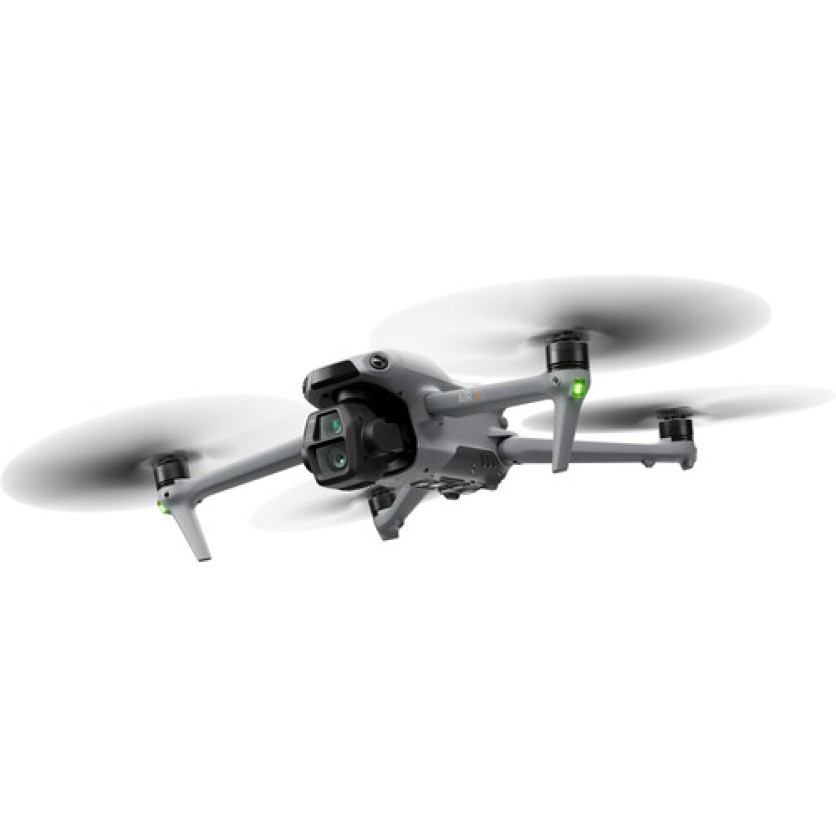
Enhanced Nighttime Capabilities
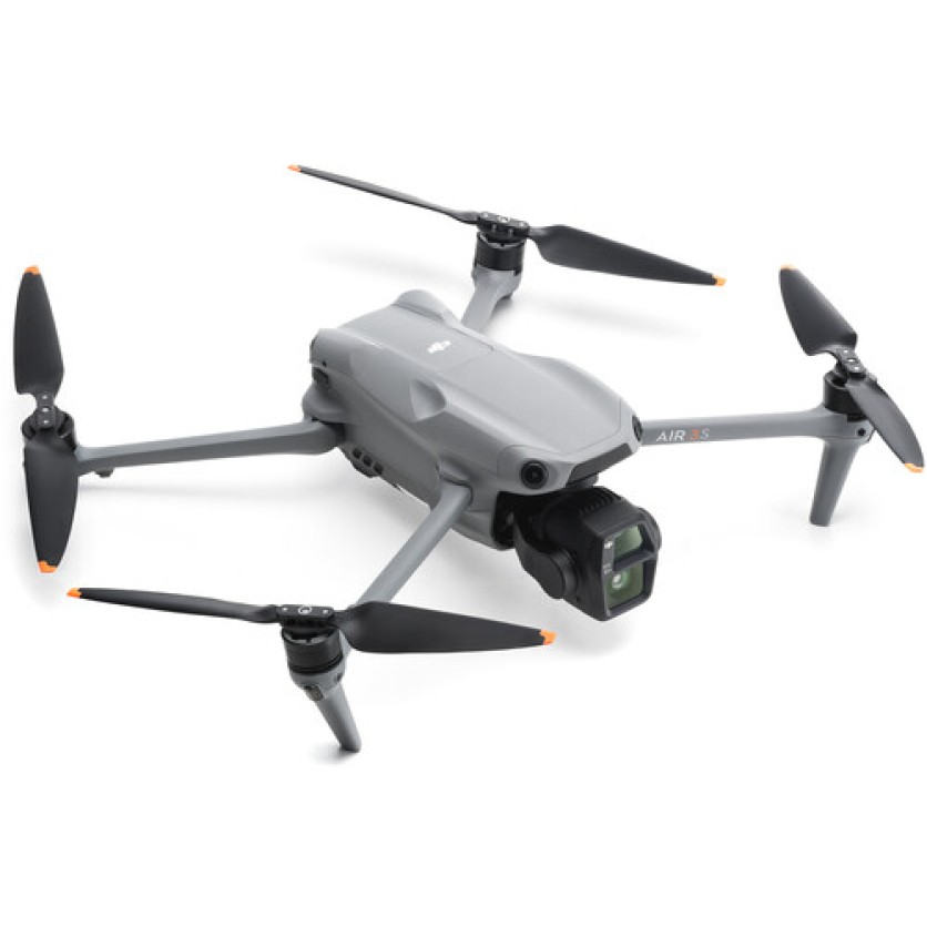
Featuring a forward-facing LiDAR sensor, the DJI Air 3S Drone enhances night flight safety with improved obstacle detection and return-to-home functionality.
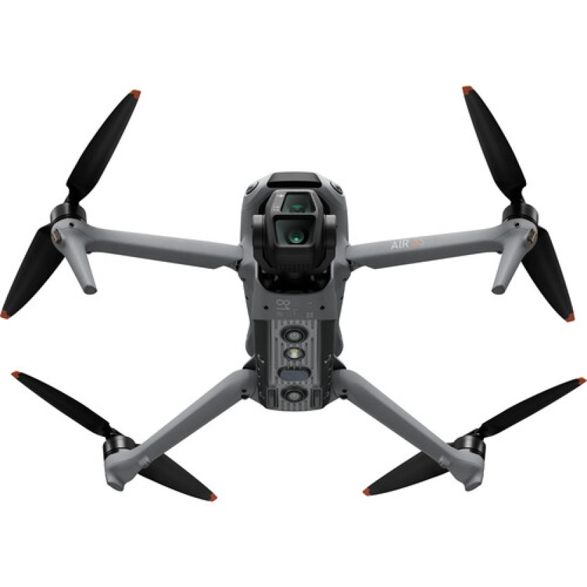
Diverse Camera System
With a dual-camera setup, including a 24mm wide-angle and a 70mm telephoto, capture both landscapes and portraits in stunning detail.
Creative Flexibility
Utilize features like 2.7K vertical shooting, MasterShots, QuickShots, and Hyperlapse for dynamic content creation.
Long-Lasting and Portable
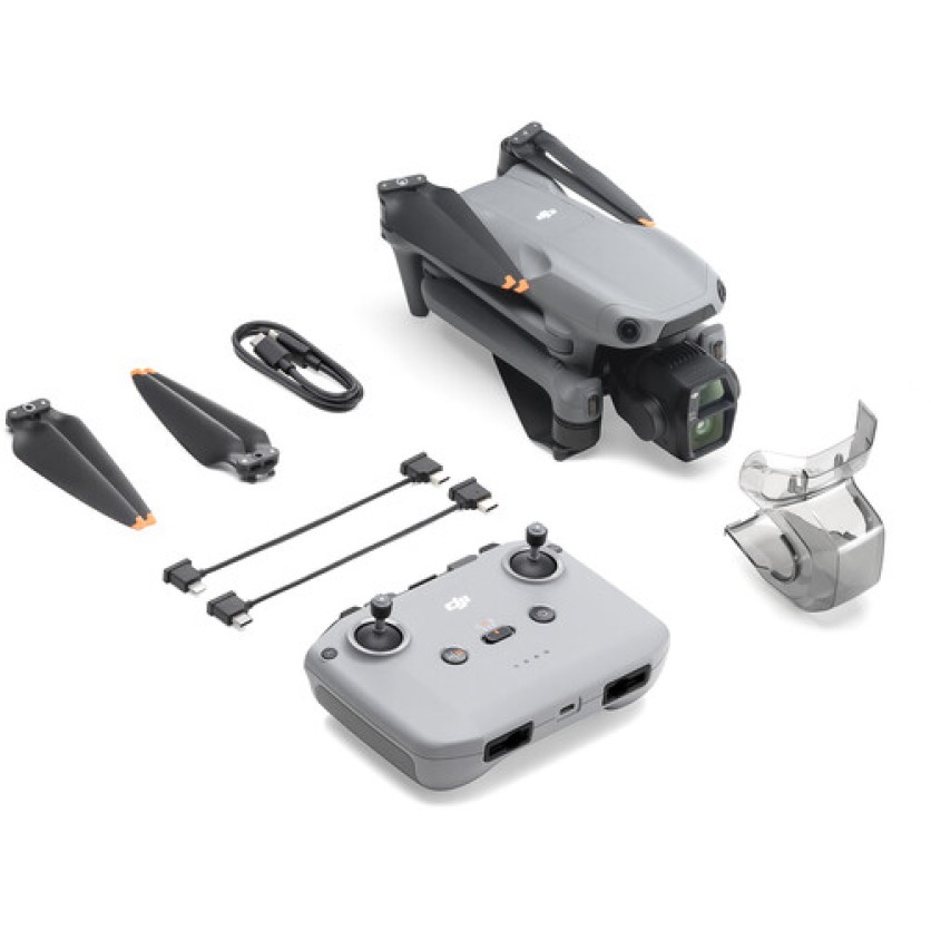
Enjoy up to 45 minutes of flight time and a compact, folding design for easy transportation.
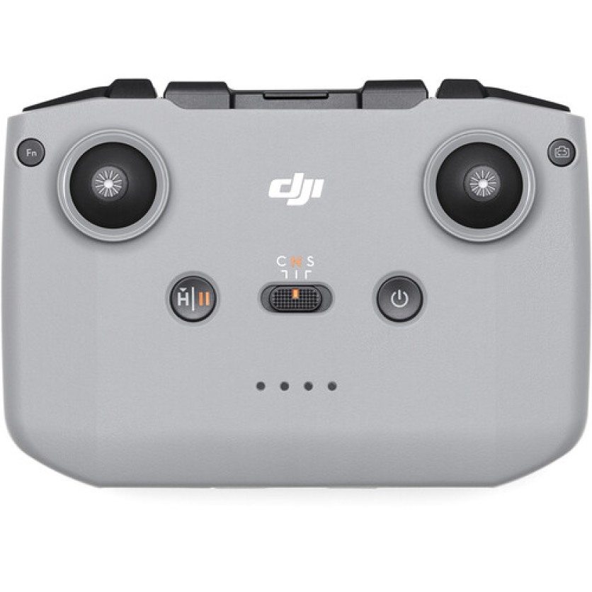
Advanced Control and Storage
The RC-N3 remote and 42GB internal storage ensure seamless operation and ample space for footage.
Specifications
Performance
Maximum Horizontal Speed
47.0 mph / 21 m/s
Maximum Ascent Speed
22.4 mph / 10 m/s
Maximum Descent Speed
22.4 mph / 10 m/s
Maximum Wind Resistance
26.8 mph / 12 m/s
Maximum Take-Off Altitude
3.7 Miles / 6000 m
Maximum Flight Time
45 Minutes
Maximum Hover Time
41 Minutes
Maximum Tilt Angle
36°
Hovering Accuracy
Vision Positioning
Vertical
±0.3' / 0.1 m
Horizontal
±1.0' / 0.3 m
GNSS
Vertical: ±1.6' / 0.5 m Horizontal: ±1.6' / 0.5 m
Aircraft
Rotor Configuration
Quadcopter
Aircraft I/O
1x USB-C Input/Output (Data, Power)
Operating Conditions
14 to 104°F / -10 to 40°C
Imaging
Number of Cameras
2
Camera System
Wide: 50 MP, 1"-Type CMOS Sensor with 24mm-Equivalent, f/1.8 Lens (84° FoV) Medium Telephoto: 48 MP, 1/1.3"-Type CMOS Sensor with 70mm-Equivalent, f/2.8 Lens (35° FoV)
Digital Zoom
Wide: 1 to 2.9x Medium Telephoto: 3 to 9x
Minimum Focus Distance
Wide: 1.6' / 0.5 m Medium Telephoto: 9.8' / 3 m
ISO Sensitivity Range
Wide Photo: 100 to 6400 Wide Video: 100 to 12,800 Medium Telephoto Photo: 100 to 6400 Medium Telephoto Video: 100 to 12,800
Shutter Speed
Wide: 1/8000 to 2 Seconds (Photo) Medium Telephoto: 1/16000 to 2 Seconds (Photo)
Maximum Video Resolution
Wide: Up to UHD 4K at 120 fps / 1080p at 240 fps Medium Telephoto: Up to UHD 4K at 120 fps / 1080p at 240 fps
Still Image Support
Wide: Up to 12 MP (DNG / JPEG / Raw) Up to 50 MP (DNG / JPEG / Raw) Medium Telephoto: Up to 12 MP (DNG / JPEG / Raw) Up to 48 MP (DNG / JPEG / Raw)
Photo Modes
Auto-Exposure Bracketing (AEB), Burst Shooting, Interval, Single Shot
Media/Memory Card Slot
In Aircraft Body microSD/microSDHC/microSDXC [512 GB Maximum / U3/V30 or Faster Recommended]
Internal Storage
In Aircraft Body 42 GB
Gimbal
Number of Axes
3: Pitch (Tilt), Roll, Yaw (Pan)
Rotation Range
Controllable Range Yaw (Pan): 10° (-5 to 5°) Pitch (Tilt): 150° (-90 to 60°)
Mechanical Range
Yaw (Pan): 54° (-27 to 27°) Roll: 100° (-50 to 50°) Pitch (Tilt): 205° (-135 to 70°)
Follow Speed
Tilt: 100°/s
Stabilization Accuracy
±0.0037°
Avoidance/Sensing System
Sensing System
Omnidirectional with LiDAR Enhancement
Sensing System Capabilities
Forward: Measurement Range: 1.6 to 59.1' / 0.5 to 18 m Detection Range: 1.6 to 656.2' / 0.5 to 200 m Max Speed: 33.6 mph / 15 m/s Field of View: 90° (Horizontal) / 72° (Vertical) Backward: Measurement Range: 1.6 to 59.1' / 0.5 to 18 m Max Speed: 31.3 mph / 14 m/s Field of View: 90° (Horizontal) / 72° (Vertical) Lateral: Measurement Range: 1.6 to 98.4' / 0.5 to 30 m Max Speed: 31.3 mph / 14 m/s Field of View: 90° (Horizontal) / 72° (Vertical) Upward: Measurement Range: 1.6 to 59.1' / 0.5 to 18 m Max Speed: 13.4 mph / 6 m/s Field of View: 72° (Front-to-Back) / 90° (Side-to-Side) Downward: Measurement Range: 1.0 to 45.9' / 0.3 to 14 m Max Speed: 13.4 mph / 6 m/s Field of View: 106° (Front-to-Back) / 90° (Side-to-Side)
Remote Controller / Transmitter
Control Method
Included Transmitter with Smartphone/Mobile Device
Operating Frequency
2.4 GHz (2.400 to 2.4835) 5.1 GHz (5.170 to 5.250) 5.8 GHz (5.725 to 5.850)